
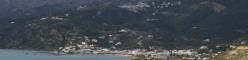
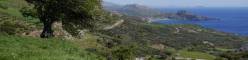


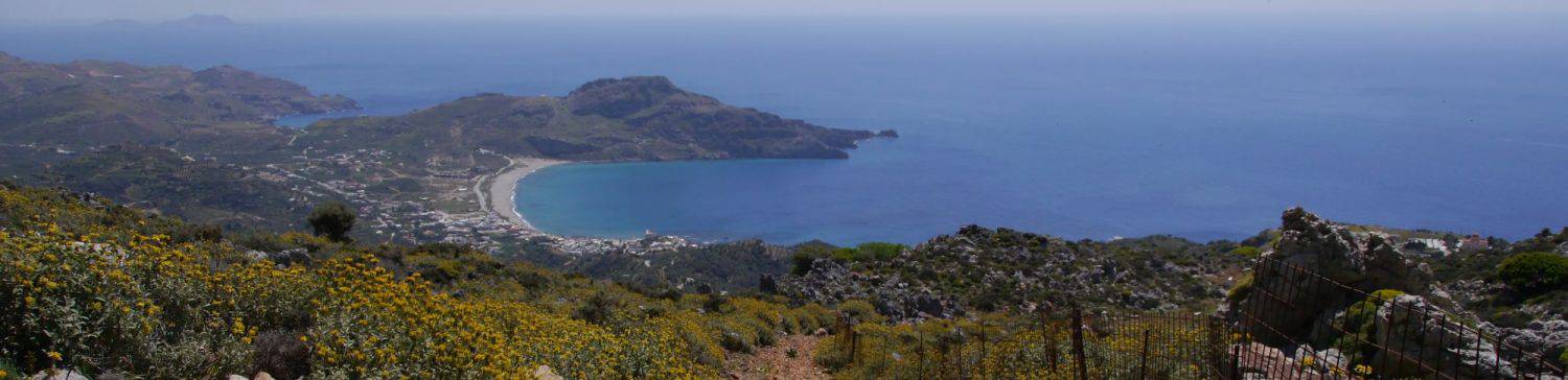
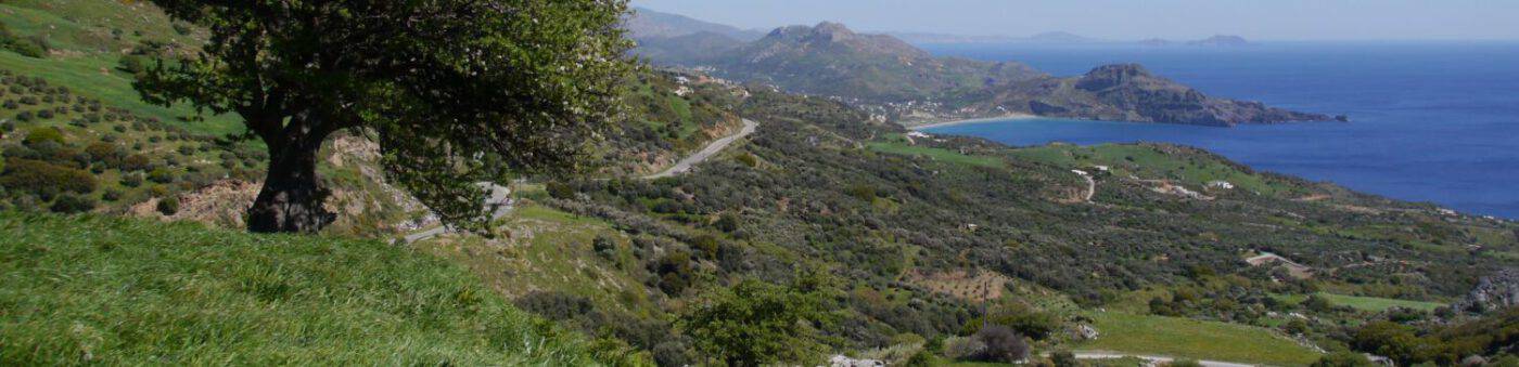

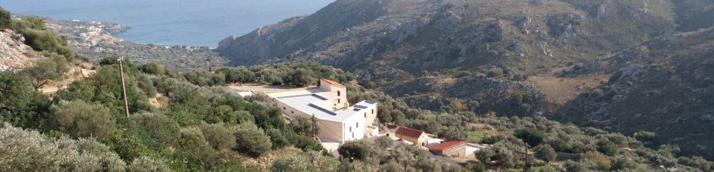


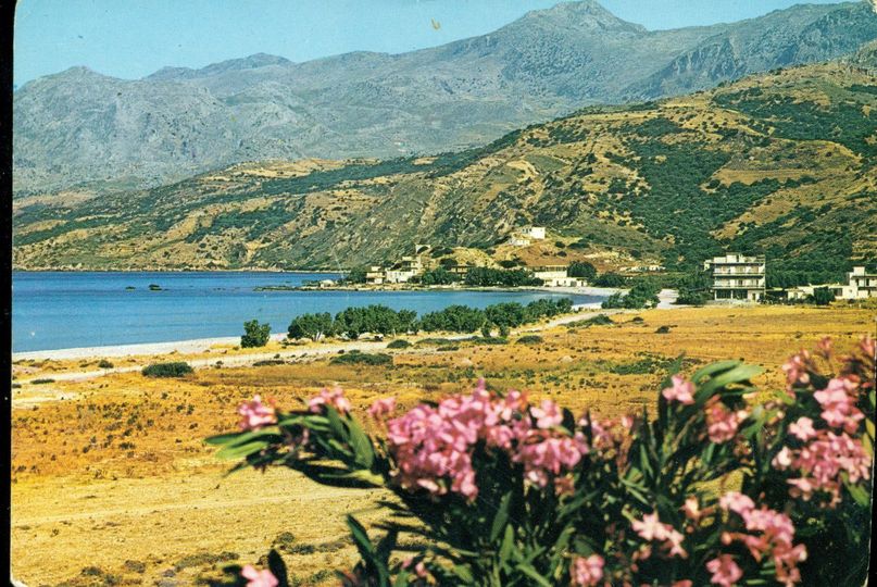
Location of Plakias
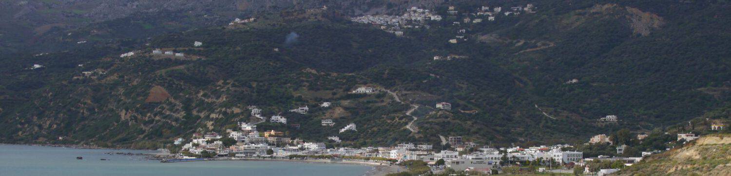
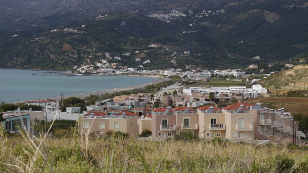
Plakias is located on the Libyan Sea, about 35 km from Rethimno. This settlement is ‘operated’ and administered by the two villages of Sellia und Mirthios “located above the mountain. According to the 2011 census, 325 permanent residents live in it. The place gives the impression that it has been equipped with hotels, cafes, taverns, rooms for rent, supermarkets, camping, clubs, post office, pharmacies, etc. almost forever.
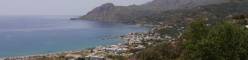
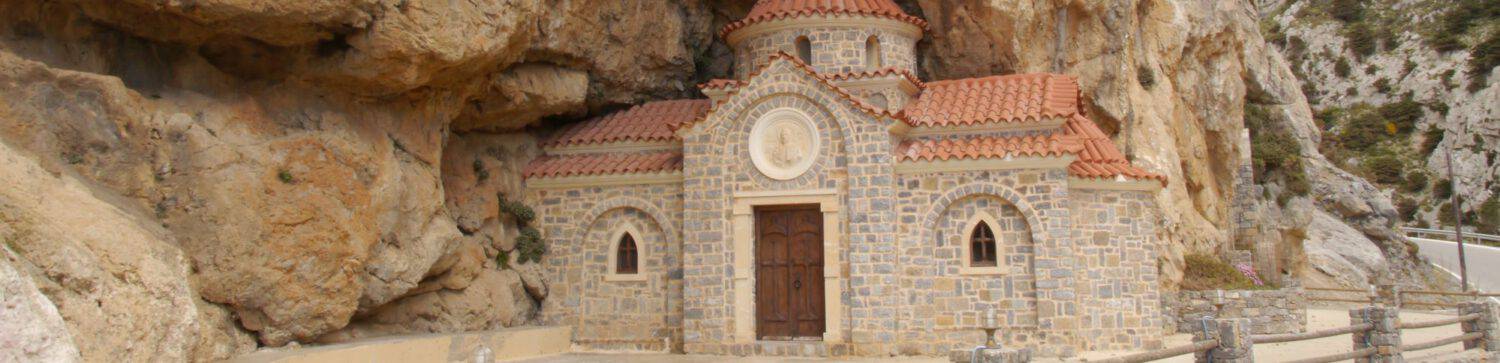
The name of this place goes back to the sandstone slabs (plaka – πλάκα = slab) in the bay. There is another, albeit very controversial, theory, according to which the name comes from the early Byzantine tombstones found in the vicinity of the chapel ‘Zoodochos Pigis’ (on the northern edge of the village between the road to Sellia and the path to the old mill ).
Early history
The Plakias of the past was initially no settlement at all, the bay only served as an anchorage for occasional fishing during the summer months for some residents of the villages of Sellia and Mirthios and housed only some huts here and there.
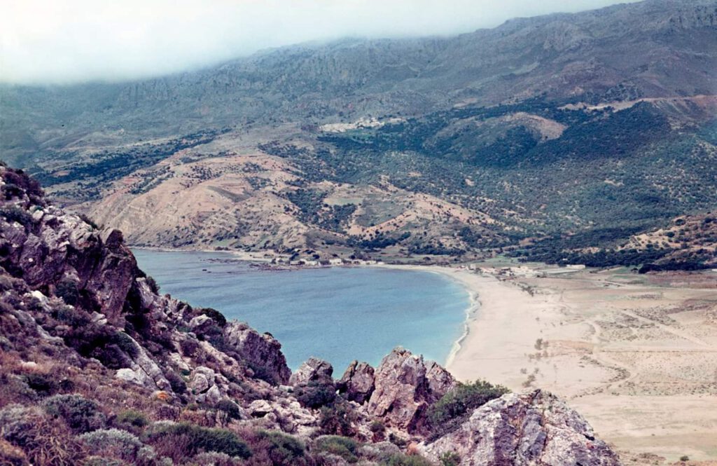
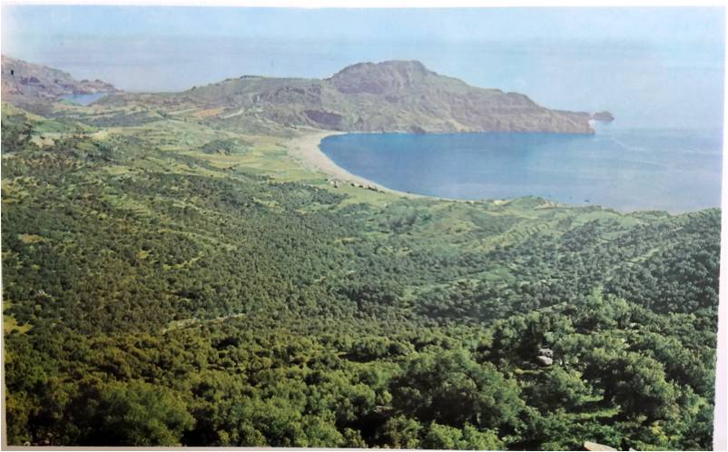
The Bay of Plakias has never offered itself as a natural harbor because it is not protected from wind and high water and the water depth was too shallow for larger boats or ships. Otherwise it would have been an ideal site for the early development of a larger settlement, given the extensive valley floor to the east of the bay.
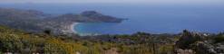
The headland at the end of the bay, the Kakomouri or charted as Cape Psarela, has two notable holes in addition to the striking cliff. They are called ‘gonates’ (gonato – γόνατο = knees). According to legend, the giant knelt thereDigenes Akritas (main character and namesake of the most important Byzantine heroic epic) to drink from the springs of Megapotamos (rising in the Kourtialotis Gorge).
According to the latest archaeological findings (see hier (English)) there are indications in the nearer and further surroundings to a Stone Age settlement of Crete, which goes back at least 130,000 years and thus represents evidence that sea voyages took place even then (the current oldest evidence of sea voyages refers to 60,000 years BC with the settlement of Australia). In addition, numerous Minoan, Doric, Roman, Byzantine, Venetian and of course Ottoman cultural remains can be found, although no finds correspond to the size of cultural centers such as Knossos, Festos, Gortyn, Zakros, Cydonia and the like. even come close. Concerning Plakias directly, reference can be made to the ancient sites of Lamon, Appolonia and the Phoinix Lappas, the exact localization of which, however, has not been 100% reliably proven to this day, as different sources give different information.
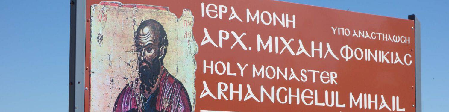
According to scientific research, the apostle Paul set foot on Cretan soil in Souda Bay west of Plakias and preached the words of Jesus Christ in Finikia, which was then above the bay.
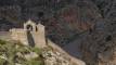
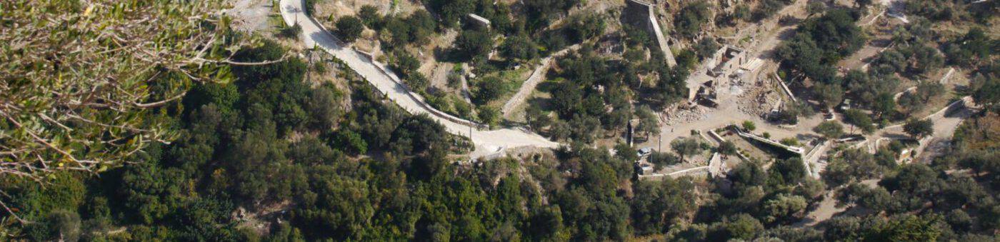
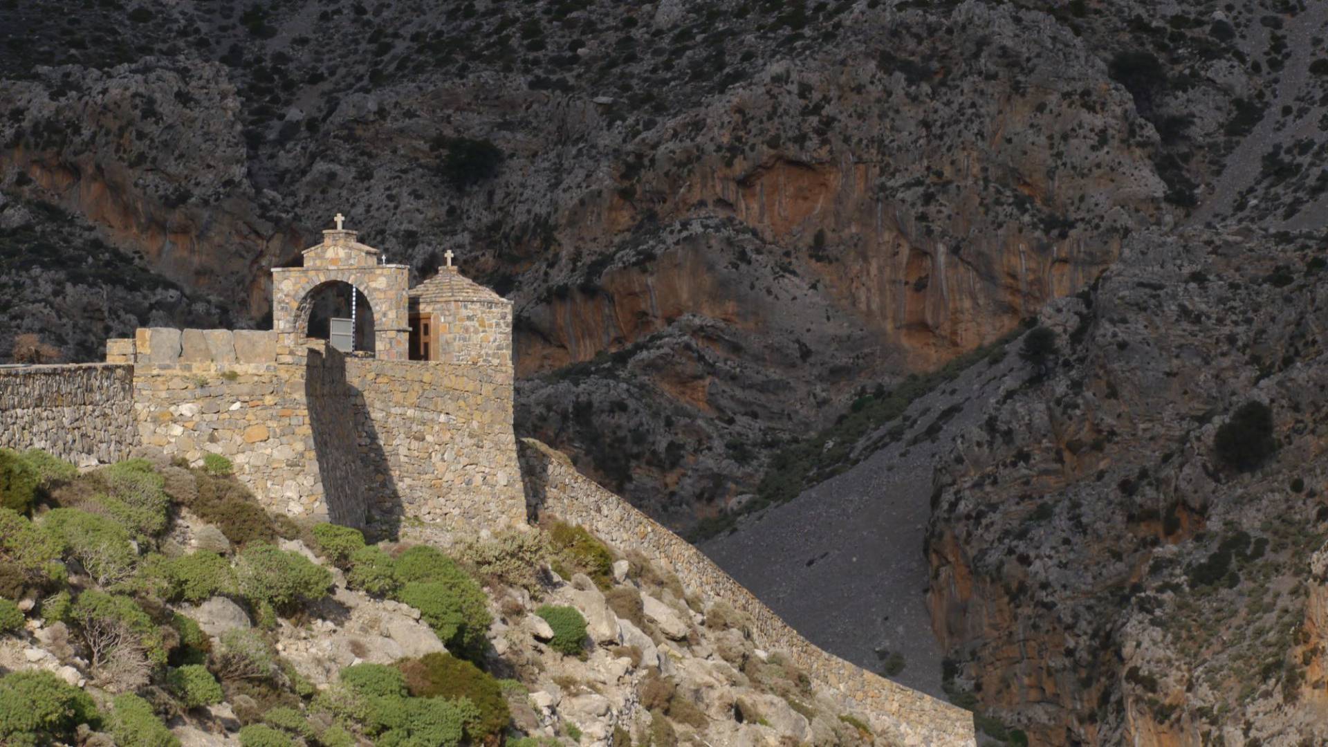
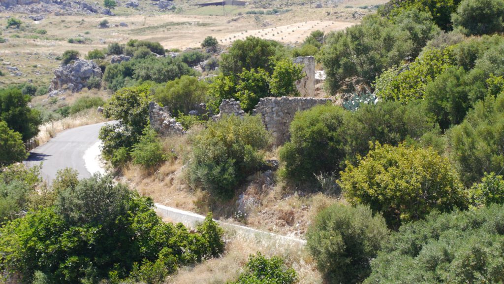
On a hill almost due east above today’s Hotel Alianthos are the remains/ruins of a fort used by the Ottomans as a police sentry station to control the surrounding villages and beaches. It is very likely that the Venetians used this fortress for the same purpose. Said hill is called ‘Koules’ by the locals (Koules always means a fortress in Greek and is derived from the corresponding Turkish word ‘kule’; see also the Koules in Heraklion). Between 1900 and 1904 the building was demolished by residents of Mirthios to the present day remains.
Since the Venetian period (probably), water mills have been used by the population of the surrounding villages to grind grain. There were four mills in the Kotsifou Gorge on the east bank of the river operated from Mirthios and a fifth mill belonging to Sellia west of the river. Today, four mills can still be clearly located as ruins, of which the two upper ones have since been restored. Another mill belonging to Sellia, the Pigado Mill, was/is located directly above Souda Bay at the creek that flows into said bay. The remains of the Pigado mill have now been integrated into a new private building. Residents of the island of Gavdos also came with their boats to both Plakias and Souda to be able to paint their grain.
Recent history Plakias
The history of the settlement of Plakias begins at the beginning of the 20th century and is very closely connected with the commercial exploitation of the lignite deposits south of Mirthios by a German company. At the same time, it is closely linked to fishing at the fishermen’s anchorage, today’s pier, in the immediate vicinity of which the structural development was then mainly to take place.
Lignite
During the Egyptian occupation of Crete (1830-1840), lignite deposits were discovered in 1839. Since the Egyptians had to leave Crete in 1840, they could not realize their plans to mine the ore and build a port. In 1845, the French researcher Victor Raulin described the quality of brown coal as inferior. The same result was expressed in 1897 by the geologist and paleonthologist Vittorio Simonelle.

The coal was mined by a German company until 1929. It was mined from five shafts south of Mirthios with maximum depths of 30-40m. These shafts have now been filled in and can no longer be precisely located today. The coal was transported on a lorry on rails about two kilometers to the ‘Gonates’ on the Kakomouri, where it was shipped. The remains of the mole needed for loading onto ships can still be seen on the ‘Gonates’ today. And if you go diving there, you should find the mine carts that were sunk by children back then.
It was this German company that built the first two buildings of the Plakias settlement: the ‘Spitara’ (today the cafe ‘Ostraco’, formerly the restaurant ‘Sofia’) and next to it a bakery (later a confectionery, currently ‘Corner Souflaki’). The ‘Spitara’ was used as a grocery store and canteen for the lignite workers.
Fishing und „Katsouni“
As already mentioned, fishing was only pursued during the summer months in order to obtain an additional income in addition to agriculture and animal husbandry. The unweighed fish was prepared on the spot and eaten in company. The rest was sold to vacationers and to locals coming down from the villages. What was left over was transported on donkeys to the surrounding villages of what was then the province of Agios Vasilios for further sale.
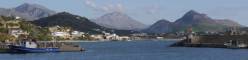
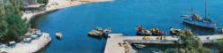
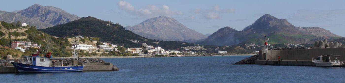
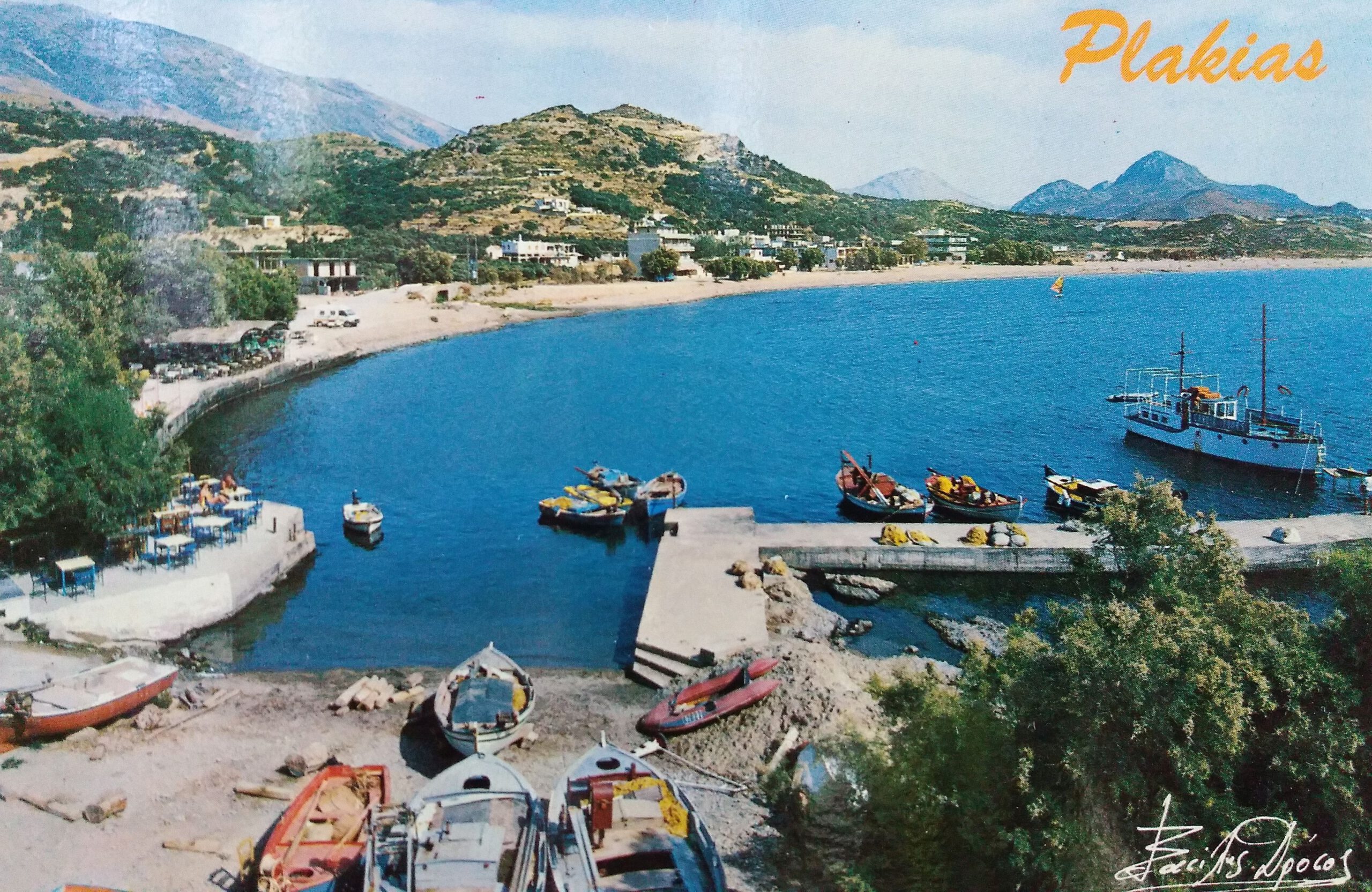
The area around today’s pier was called ‘Katsouni’. The ‘port area’ of Plakias, so to speak, or the ‘old town’. Here the boats were tied up in the water or jacked up on land. At first there was no mole; it was only built in the late 1950’s in a length of 10 meters by cementing out existing boulders, together with an additional cement platform. In the course of the following decades, the pier was gradually expanded to its current form, including the breakwater.
The term ‘Katsouni’ for the ‘port area’ has unfortunately been lost in recent decades and in the course of tourist development – only a few locals know this term today …
This ‘port’ was never a port in the sense of safely mooring boats and ships. It was exposed to the often very violent south-west winds, especially in winter. The boats were either ‘anchored’ on ‘Katsouni’ or, as it was more protected, in Souda Bay on land.
Since 2010, the new and more sheltered port, the construction of which was funded by the EU, has been in operation west of Plakias on the way to Souda Bay.
German occupation in Plakias
During the period of German occupation, houses were requisitioned, some were fortified, some were fenced in and put to fascist use. In the Mirthios part, houses were used as storage places. There were guard posts at Mirthios, Gonates, Damnoni and Stavri (Souda Bay).
During this Nazi rule the lignite shafts were reactivated. Part of the output was taken by lorry to be shipped to the ‘Gonates’. The larger part was transported by donkey through the Kotsifu Gorge and loaded onto requisitioned and army trucks in Kanevos.
Settlement start/construction activities
The first building of the Plakias settlement was built by the German brown coal company at the beginning of the 20th century, called ‘Spitara’ and later houses the tavern ‘Sofia’, today the cafe ‘Ostraco’. In the years that followed, around 10 more buildings were built around the ‘Katsouni’, i.e. in the part of Plakias that belongs to Sellia. Also in the Mirthios part a handful of houses were built in the interwar period. Until the 1950s and 1960s, these two settlement parts of Plakias were mainly inhabited only in the summer – the 1961 census counted 6 families permanently living there.
In the course of the still delicate development of tourism in the 1960s (with mainly Cretan and Athenian visitors), the Greek government commissioned an architectural planning study for the tourist development of the settlements of Plakias and Agia Galini, which was published in 1968. The residential units with capacities for 1,500 to 3,000 beds should fit organically into the environment and be a modern expression of more traditional construction. Part of the study was also the integration of infrastructural measures both for the tourist part and for the local economy. The residential units were to be built in the Paligremnon area, i.e. at the southern end of Plakias Bay, but also north of the existing Plakias settlement. This plan study was never implemented.
The touristic expansion of Plakias began very gently in the 1970s and intensified in the 1980s. It then proceeded mostly chaotically, at dizzying speed and initially without adequate accompanying infrastructure. The responsible villages Sellia and Mirthios competed without a common urban planning plan. It was not until 1993 that the Prefecture of Rethimnon approved an urban development plan for the entire Plakias settlement, which was only implemented in Mirthios-Plakias.
Development of tourism and infrastructure
At the end of the 1950s, the first foreign tourists appeared sporadically, the majority of whom were Australians, English and Germans. Likewise, Sellia and Mirthios natives living in Athens or Rethimnon began to spend their holidays in Plakias during the summer months.
In the sixties the first hippies appeared, very few because they settled mainly in the Matala caves (east of Plakias and south of Agia Galini). Some also lived under the Cretan date palms of Preveli.
The tourism share in the economy of the settlement Plakias was still quite modest until the beginning of the eighties, even if the number of taverns had increased and already in 1973 the Hotel Livikon opened in Mirthios-Plakias. The aforementioned chaotic and wild building boom into the 1990s was in response to a growing influx of tourists. The former tranquil summer fishing settlement on ‘Katsouni’ has become one of the most important tourist ‘hotspots’ on the south coast of Crete, alongside Paleochora, Agia Galini and Ierapetra.
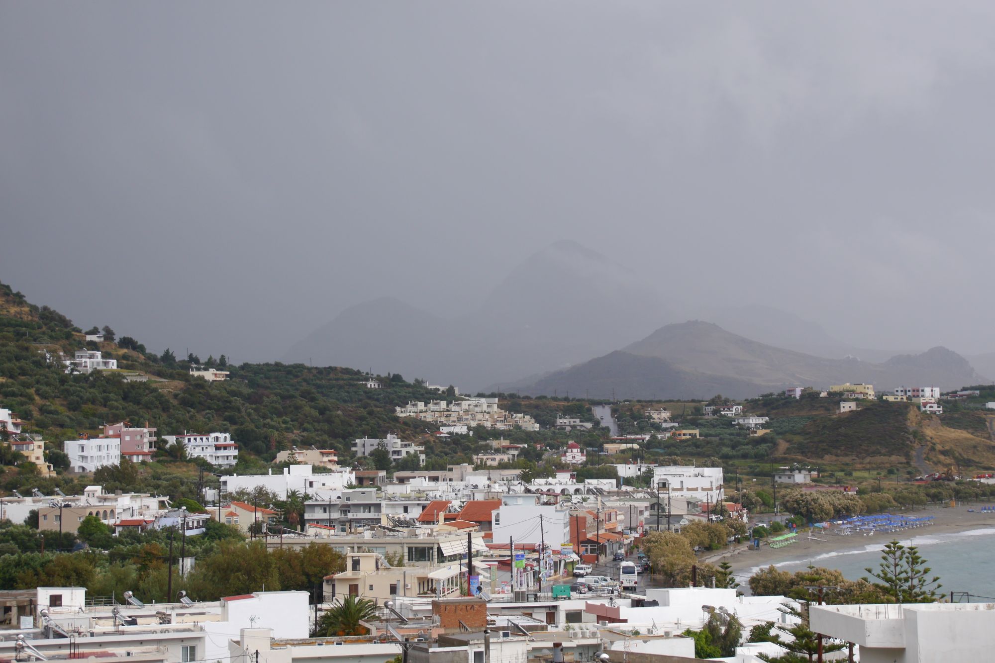
The infrastructure of the place developed as a reaction to the growing needs of the population, the increase in tourists, their demands and the building frenzy since the eighties.Plakias was electrified in 1971, has had water mains since the late 1970s and a municipal sewage treatment plant since the early 1990s. Streets were paved, widened, upgraded. Numerous supermarkets, two pharmacies, a doctor’s office, a post office, various bicycle, car, motorcycle and other rentals emerged. Free parking spaces and several gas stations were added. Taverns, restaurants, cafes, bars, discos ensure daily and nightly well-being. Hotels, rental rooms and a camping offer accommodation as their services.
Anyone who would like more detailed information about the history of Plakias and is sufficiently proficient in English should definitely read the book by Charis (Charidimos) Papadakis ‘Plakias in the past’ listed below! However, it is questionable whether it is still available in the local shops.
Sources:
- Χαρίδημος Α. Παπαδάκης – Ο Πλακιάς του χθές / Charidimos A. Papadakis – Plakias in the past, 2. Auflage griechisch-englisch, Rethimno 2017, ISBN 978-960-93-2155-6
- Official website of Agios Vasilios Municipality(http://www.agios-vasilios.gr/)
- Κώστης Ηλ. Παπαδάκης – Πλακιάς (Σελλιανός και Μυρθιανός), Σ. 511 – 520 ΓΙΑ ΤΗΝ ΠΡΩΗΝ ΕΠΑΡΧΙΑ ΑΓΙΟΥ ΒΑΣΙΛΕΙΟΥ, Τόμος Δ, ΧΩΡΙΑ ΤΗΣ π. ΕΠΑΡΧΙΑΣ ΑΓΙΟΥ ΒΑΣΙΛΕΙΟΥ ΡΕΘΥΜΝΟΥ, Ρέθυμνο 2011 – Kostis Il. Papadakis – Plakias (Sellia and Mirthios part), pp. 511 – 520, from Volume 4 (Villages of the ancient province of Agios Vasilios) of the Report on the International Congress 2009 of the Municipalities of Agios Vasilios on the History of the Former Province of Agios Vasilios, Rethimno 2011)
What an interesting article! Thank you for the information. We’ve visited Plakias (day trips from Rethymno) for 20 years so it’s good to understand some history.
Although it is now a tourist resort, we have always enjoyed our visits as Plakias feels quite laid back.
Interesting to see see the changes this week year (parking, new road surfaces etc). Definitely improvements.