

The description of Kourtaliotis Gorge has been removed from the Asomatos text and posted as a separate, somewhat expanded description under the “Points of Interest” menu.


The description of Kourtaliotis Gorge has been removed from the Asomatos text and posted as a separate, somewhat expanded description under the “Points of Interest” menu.
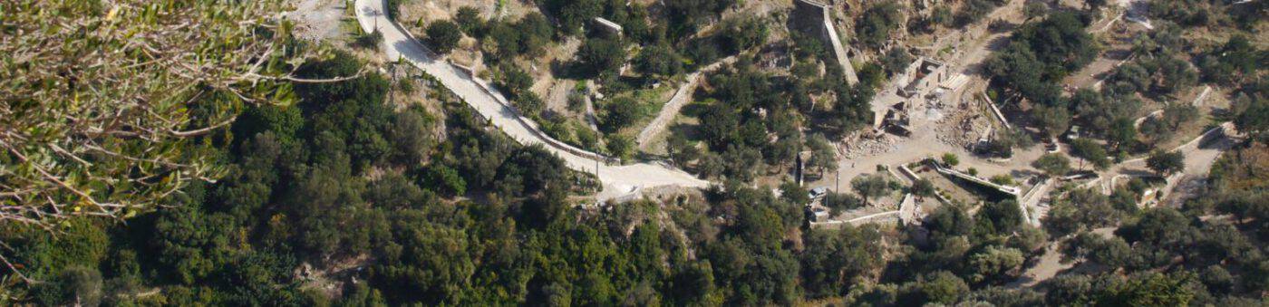
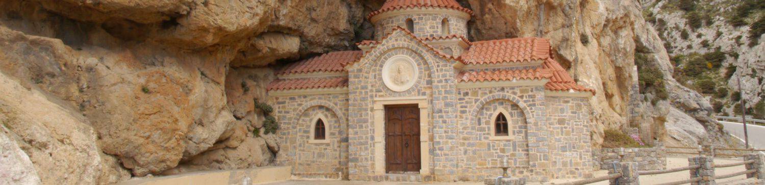
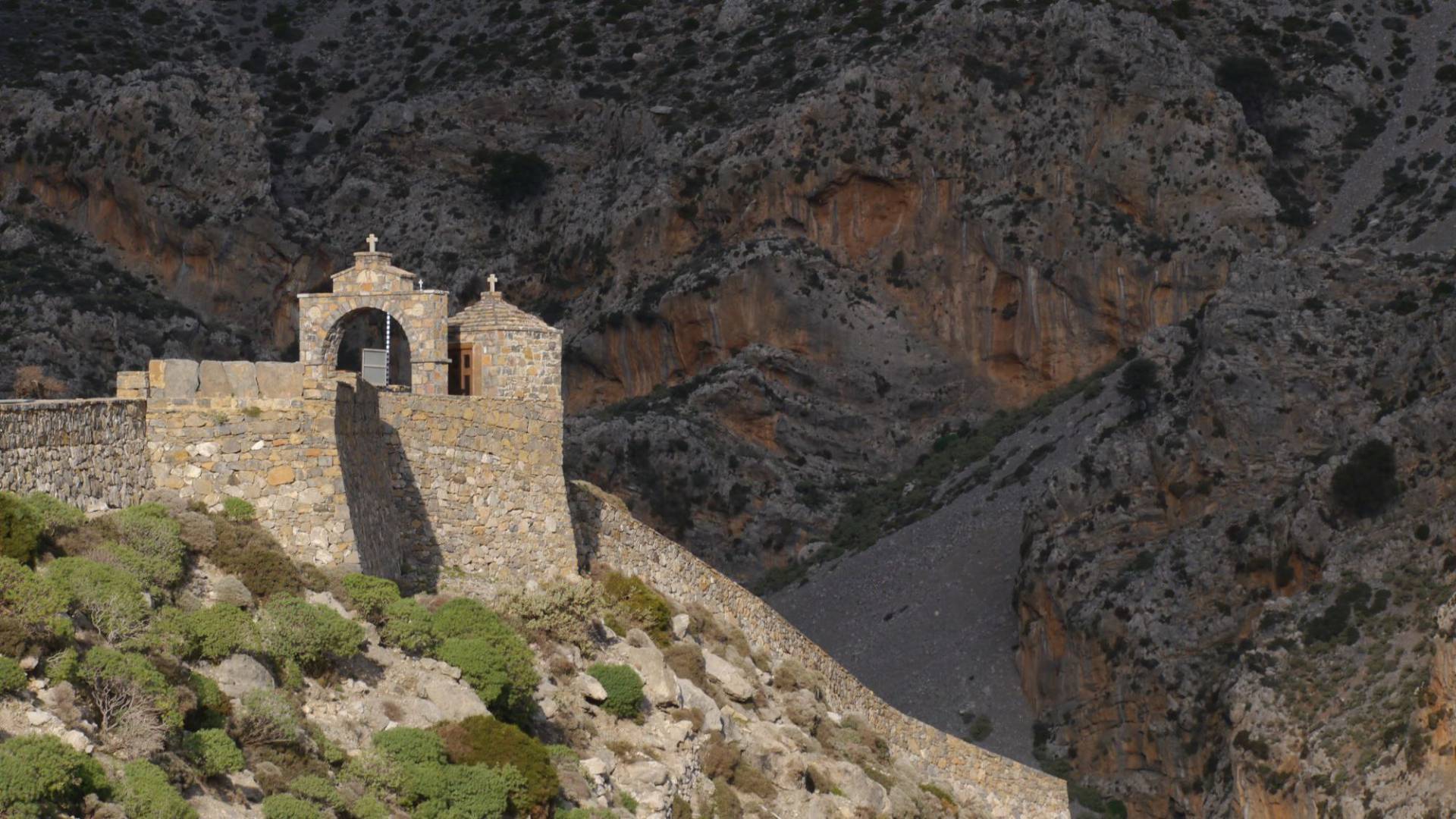
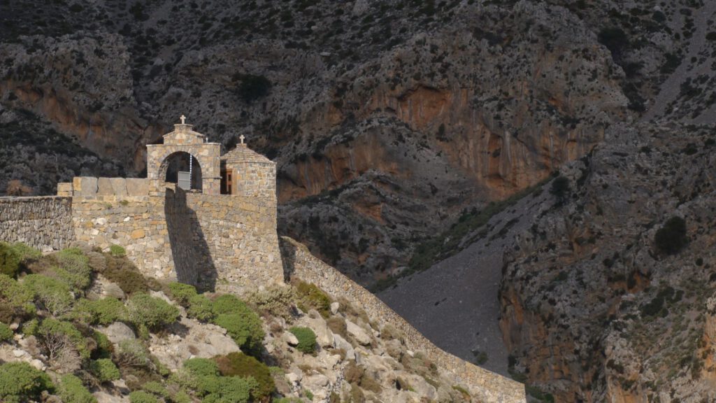
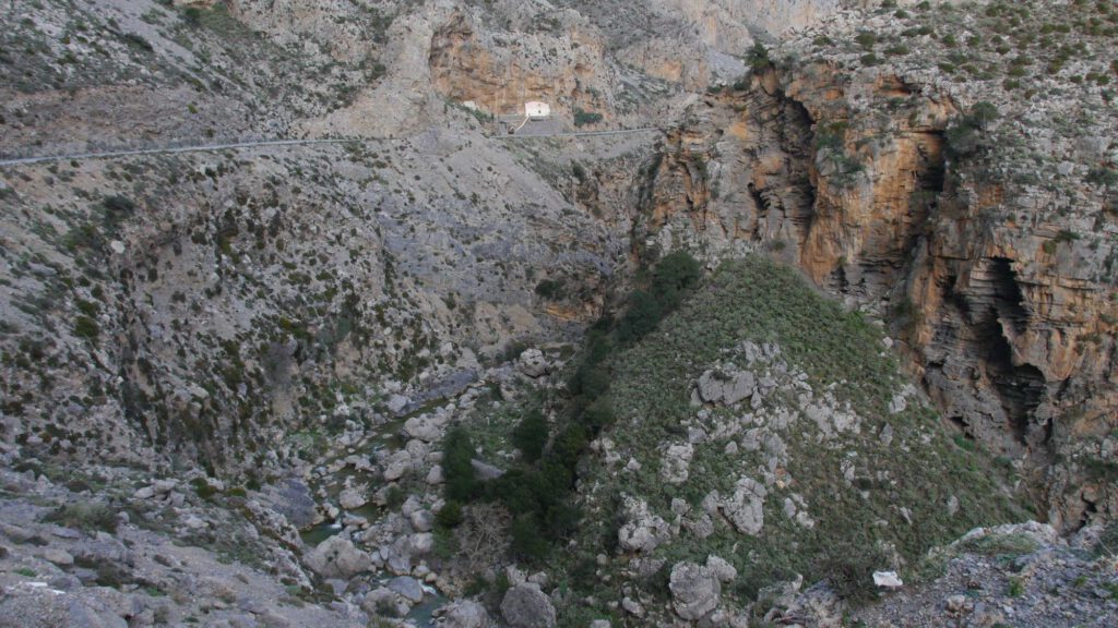
In the area where the chapel of Saint Nicholas is located at the springs of the river Kourtaliotis, the Forestry Directorate of Rethimnon and the Tax Office for Antiquities of Rethimnon have approved the installation of a wooden pavilion – a refreshment stand – which the parish of Asomatos wants to place in the area it administers.
Translation (with the help of Deepl) of the article of 20.07.2023 from www://goodnet.gr
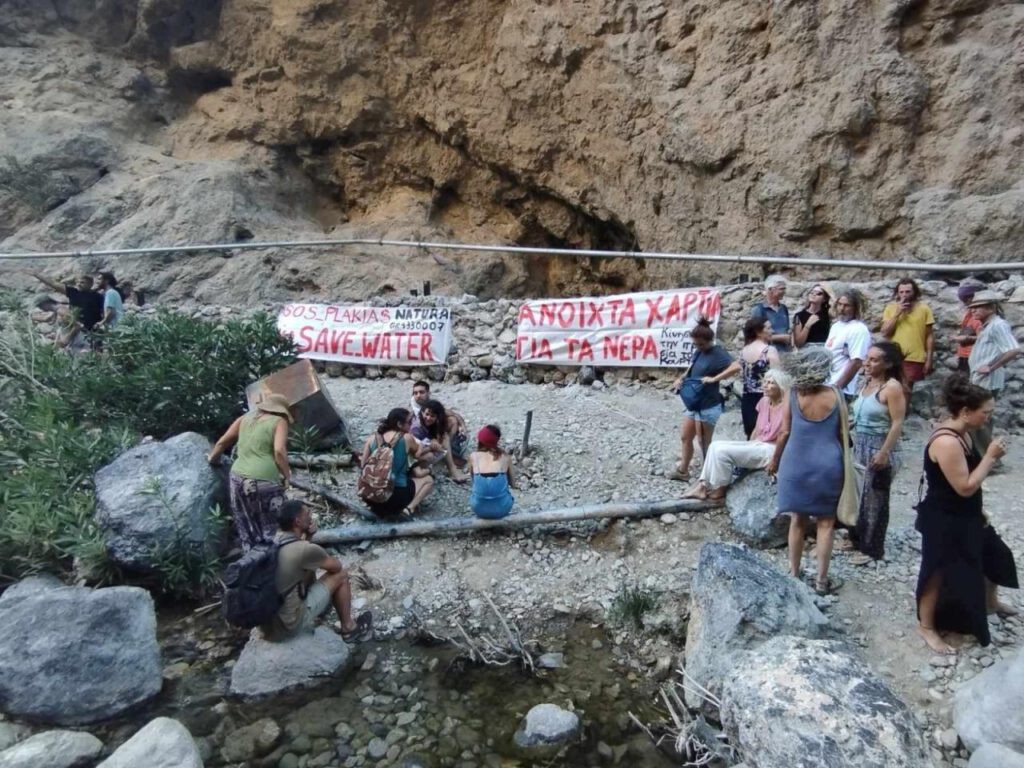
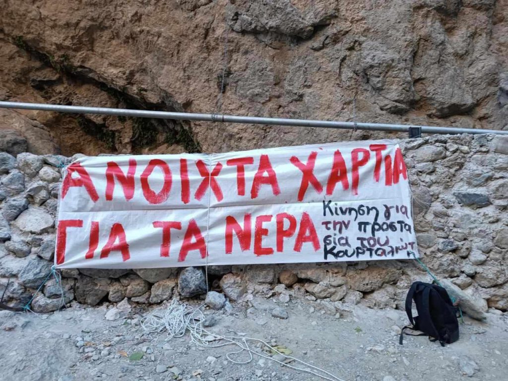
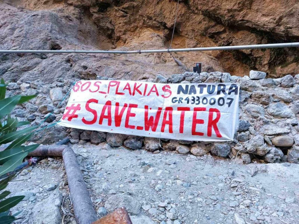
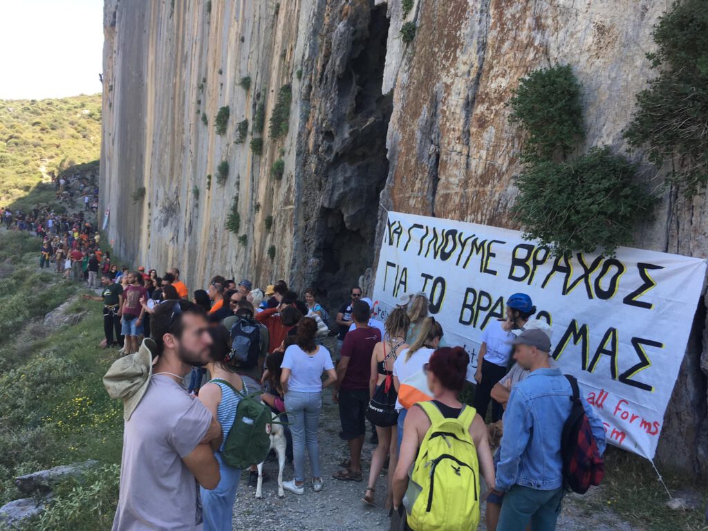
The “Movement for the Protection of the Kourtaliotis River Springs” has sent an open letter concerning the planned construction of a wooden pavilion with a refreshment room in the area of the Kourtaliotis River Springs.
Specifically, the letter highlights the following:
“As a movement for the protection of the springs of Kourtaliotis, we have recently noted that the installation of a wooden pavilion – a refreshment stand – has been approved by the Forestry Directorate of Rethimnon and the Tax Office for Antiquities of Rethimnon, which the parish of Asomatos wants to install in an area it administers, in the area where the chapel of St. Nicholas is located at the springs of the river Kourtaliotis.
This is the only access to the springs, a place of exceptional beauty and ecological value. This is the wider area of the NATURA 2000 network Kourtaliotis Gorge – Preveli Gorge (GR4330007), which is a highly protected area.
The area is classified as:
– Wildlife Sanctuary (WSA) – areas classified as suitable for the development of wildlife populations or as habitat for the reproduction, feeding and wintering of wildlife species, or as fish breeding and hatchery areas (https://ypen.gov.gr/).
– Special protection areas (Καταφύγιο Άγριας Ζωής (ΚΑΖ)) for bird fauna under Directive 2009/147/EC on the conservation of wild birds.
Under Directive 2009/147/EC on the conservation of wild birds, EU countries are obliged to take measures to avoid:
— Deterioration of the species’ habitats
— disturbance of species for which special areas of conservation have been designated, where such disturbance is likely to have a significant adverse effect on the objectives of the Directive
— deliberate disturbances that endanger conservation, etc.
– Special Areas of Conservation (SAC) and Sites of Community Importance (SCI) under Directive 92/43/EOC on the conservation of natural habitats and of wild fauna and flora.
Sites of Community Importance (SCIs) are sites that have been officially designated by the European Commission and are therefore subject to the protection provisions of Article 6(2), (3) and (4).
Special Areas of Conservation (SACs) are sites of Community importance designated by Member States through legislation and for which the necessary conservation measures have been taken to ensure the conservation of the species and habitat types of Community importance occurring there. (Natura 2000 – Environment – European Commission).
According to the European Environment Agency (Natura 2000, biodiversity.europa.eu), the site hosts 27 protected species of migratory and non-migratory wild birds, birds of prey, waders and other species that breed and nest in this particular environment (important nesting area).
The pressure on the area during the summer months due to tourism is already very high. The establishment of a canteen in the gorge would result in the setting up of tables, noise pollution (from noise, music, generators, etc.), light pollution at night, visitors generally staying longer in the gorge and possible environmental and water pollution. All of this will have a detrimental effect on the wildlife of the gorge and violate the regulations protecting the area.
We are addressing this letter to the authorities who issued the permits, to the municipality of Asomatos and to the local population. As citizens, we see it as our duty to know exactly the planned interventions (which must always be in accordance with the regulations protecting the area) on a landmarkof the prefecture. On a particularly fragile natural resource that has already been severely stressed by the presence of man and has experienced the sloppiness of infrastructure and works.
We all know that the Kourtaliotis Gorge and its springs need integrated, responsible and scientifically documented planning to protect this special environment and its wildlife, but also to allow local people and visitors to enjoy both its natural beauty and its precious water.
We hereby declare and assure that we will do everything in our power to achieve the above objectives. We ask the relevant authorities to respond to our concerns in writing so that together we can ensure the protection of this habitat for future generations.
“Movement for the Protection of the Kourtaliotis Springs”.
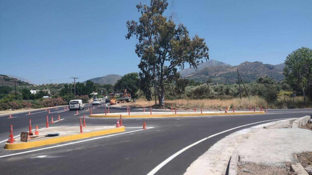
On 27.06.2023, the Koxare traffic junction was completed to restore the safety of passers-by to and from the busiest and most touristy places in the prefecture.
From the beginning of July, this provincial road 9309 is to be repaired under the title: “Urgent damage rehabilitation works on the Koxare – Asomatos – Preveli Monastery road and on the Myrthios – Mariou – Lefkogeia link road and associated roads”. It is assumed that this will improve traffic to Preveli Monastery.
Online-News at goodnet.gr from 27.06.2023, 15:46
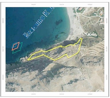
The Official Gazette of the Greek Government (FEK 535D of 23.06.2023) published the ministerial decision taken on 22.06.2023 to place the area of Paligremnon and Cape Psarelas under preservation of nature.
On two and a half pages, the Special Conditions and Restrictions, the Transitional Provisions, the Controls and Sanctions, and the Entry into Force are detailed.
This ministerial decision can be viewed and downloaded here.

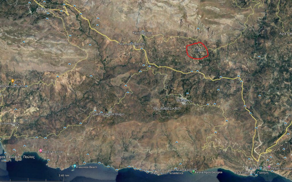
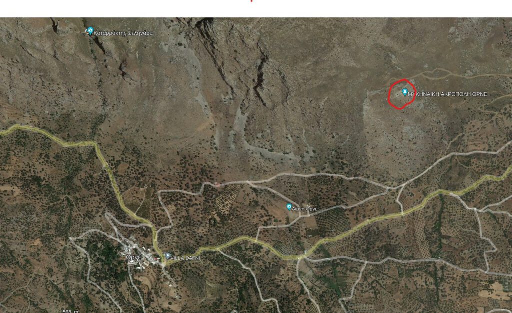
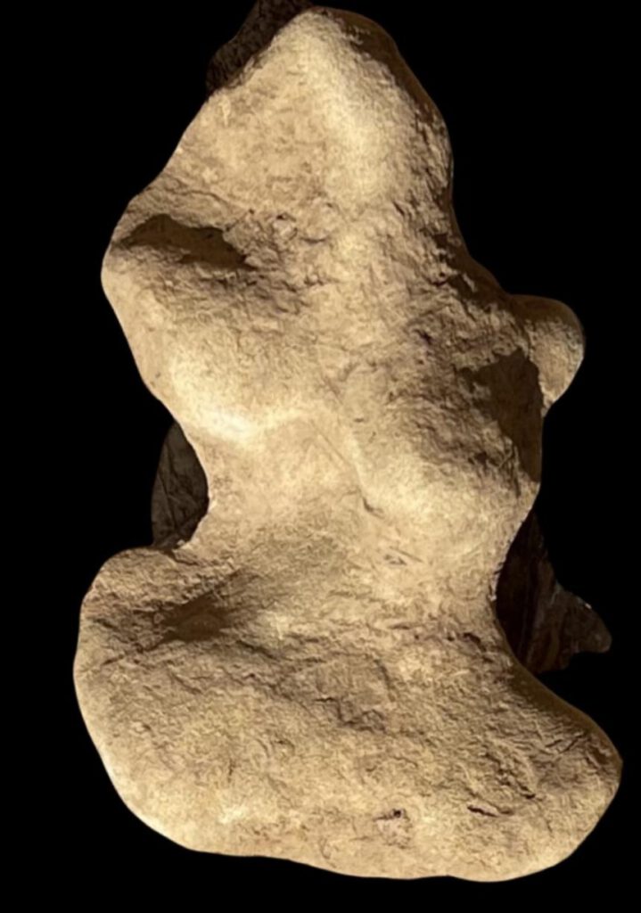
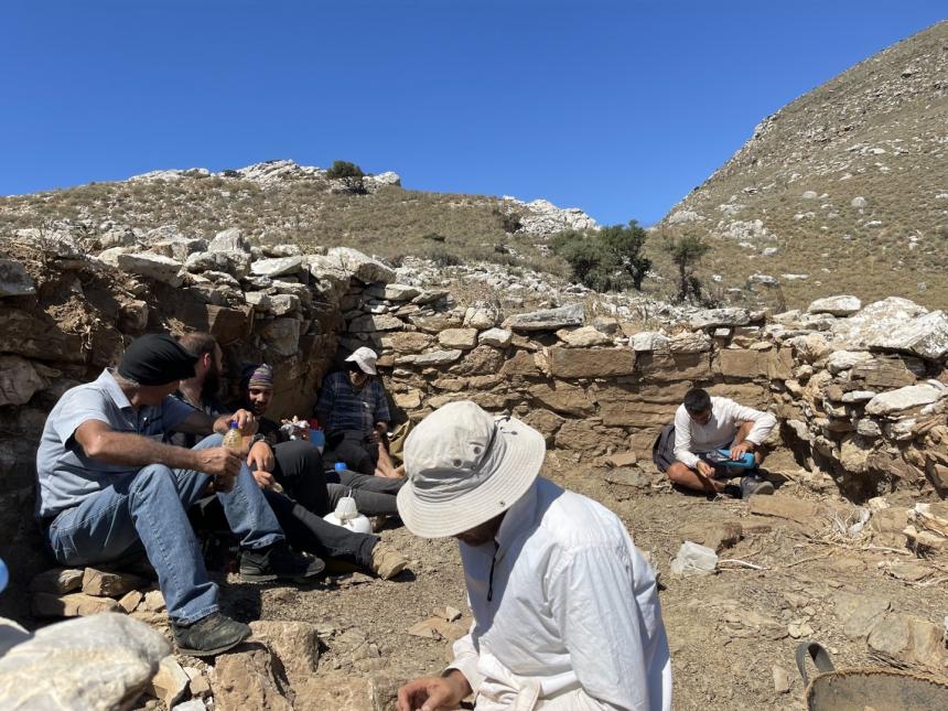
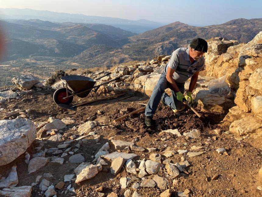
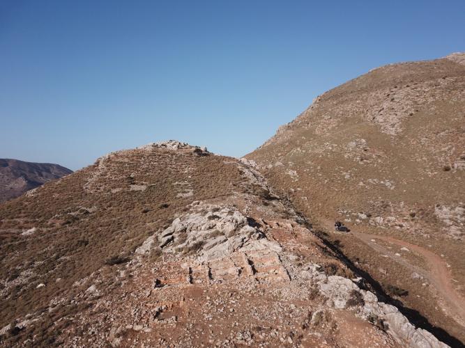
In 2022, a five-year excavation cycle was completed, during which remains of a Mycenaean acropolis were uncovered at Orne – Lambi, Agios Vasilios, Rethimnou.
The following article, translated into English, was published in Rethimnonews on 10.01.2023. . There is a picture gallery at the end of the original article.
For the chronological classification:
the Mycenaean period on Crete ranged from 1400 to 1100 BC.
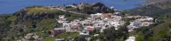
A view of the location of Orne and the site of the excavations:
Manousos Klados
IMPRESSIVE ALSO THIS YEAR’S FINDS IN ANCIENT ORNE
REQUEST FOR A NEW FIVE-YEAR PROGRAMME FOR EXCAVATIONS
A Mycenaean principality that controlled the roads to the sea in southern Crete is discovered in Orne of Agios Vasileios, where a first five-year cycle of excavations was completed in the summer of 2022.
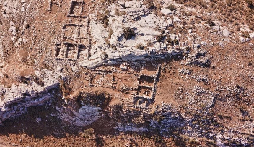
It is the largest acropolis discovered on Crete and one of the largest that archaeological excavations have uncovered so far in the south-eastern Mediterranean. The finds are impressive and the new information about ancient Crete contributes to a better and more thorough knowledge of our island’s long past.
The extent of the archaeological wealth unearthed in the south of Rethymnon, which is of worldwide interest, has led the excavation team to apply for permission for a second excavation project, as it has become apparent that the ancient acropolis of Orne can yield even more “treasures” in terms of finds and historical knowledge.
And this is the work of eminent archaeologists who have worked hard in recent years to bring to light an “unknown world” whose “secrets” have been hidden by centuries past.
The excavation team that succeeded in “illuminating” the past “hidden in the hills of Orne” consists of Professor Nikos Chr. Stambolidis, Director of the Acropolis Museum, Professor Manolis Stephanakis of the University of the Aegean, Dr. Athanasia Kanda, Honorary Director of Antiquities of the Heraklion Regional Unit, Anastasia Tzigounakis, Director of Antiquities of Rethymnon and archaeologist Manos Papadakis.
THIS YEAR’S FINDINGS
This year’s impressive finds provide new evidence for the Mycenaean period of ancient Crete, as described in our newspaper by eminent archaeologists Athanasia Kanda and Manos Papadakis.
In particular, research continued last summer on the 12th century BC buildings, which show that the densely populated and fortified citadel had excellent architectural and urban design, indicating the existence of an organised central administration. It seems that there was a Mycenaean principality in Orne that controlled the natural routes to the sea through the area of present-day Agia Galini and also the valley of Amari to the plain of Messara.
The Acropolis, which is one of the largest in the south-eastern Mediterranean with an area of 55 hectares, was a fortified settlement in which many more people lived than previously assumed, as the buildings are very densely arranged on the enclosed site.
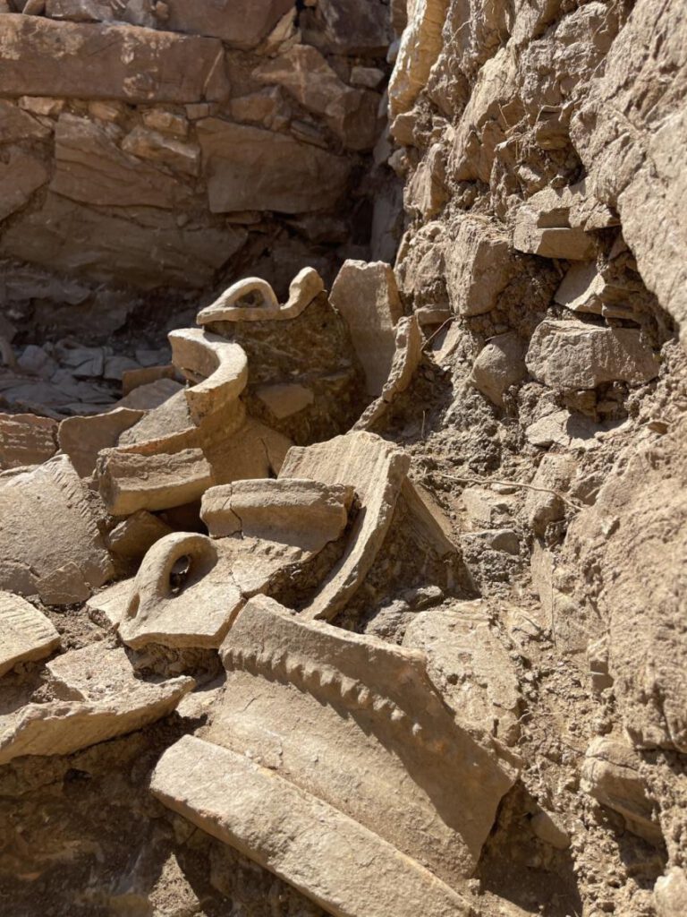
In 2022, buildings with storage and laboratory space were also found. Including a metallurgy workshop, as shown by a die, a mould for making copper beams. And in 2022 there is also clear evidence of the existence of places of worship, as shown by the figurines found in various rooms.
The streets are paved. There are impressive, very large rooms paved with slabs, as well as methane rooms (μεθρανία translates as methane throughout,, which, in my opinion, makes no sense; otherwise, a Google search for it also yields no result, note by the translator)for different purposes. The exploitation and design of the steep terrain testifies the skill of the builders and the need to use all the available land, for the citadel has flatter sections that could have been used on their own if there had not been pressure to accommodate a large number of inhabitants.
The acropolis of Ornes was destroyed by fire, probably preceded by an earthquake, as evidenced by the shaken walls and burnt beams. Inside the rooms, objects were found that were used by the inhabitants and left behind after the citadel was abandoned.
A NEW EXCAVATION PROGRAMME IS NEEDED
The 2022 excavations at the Mycenaean Acropolis of Ornes successfully completed the five-year excavation programme approved by the Central Archaeological Council.
The research was carried out with grants from the Region of Crete, the Municipality of Agios Vasileios and the Institute of Aegean Prehistory. The mayor of Agios Vasileiou, Mr. Ioannis Tatarakis, and the staff of the municipality have been instrumental in supporting the excavation work.
The excavation team has already applied for approval for a new five-year programme of excavations on the Acropolis with a new application to the Ministry of Culture and Sport.
The new programme is absolutely necessary and reflects a promising future of excavations and discoveries.
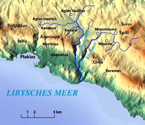
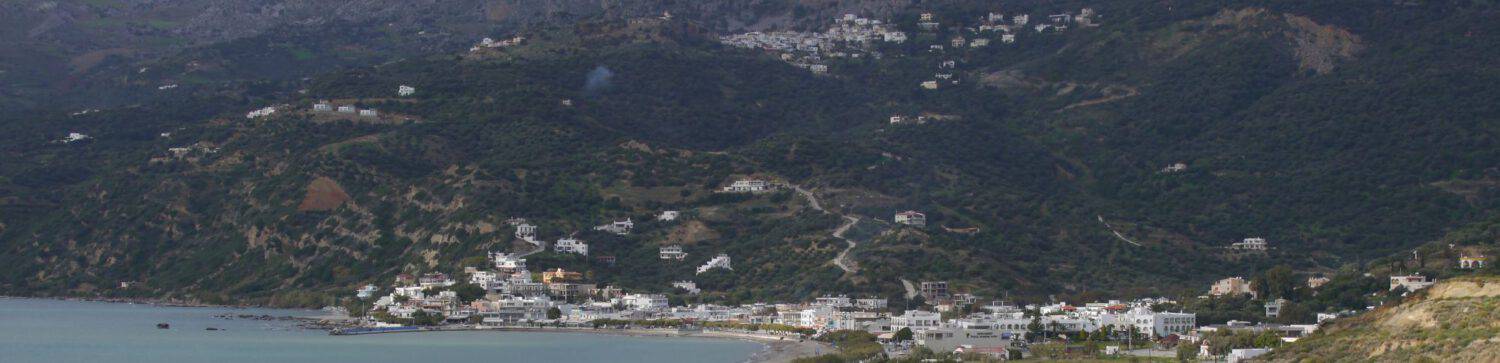
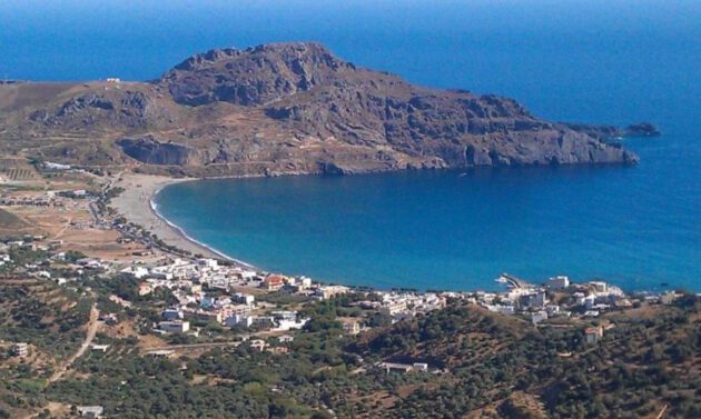
Already at the end of January 2020, “Rethimniotika Nea” reported about the remodeling works planned in Plakias, but only visible this year and not yet completed.
The completion of the changes to the promenade (new sidewalks, narrowing of the main road and new furniture) east of the Kotsifou (Mirthianos Plakias) seems to be finished soon. This means that the eastern section will still have to be redesigned, with the through road there becoming a one-way street. In addition, the construction of the ring road, held as a one-way road (presumably), is pending. Whether the laying, at least partially, of the new water supply network has already been done, is not clear to me at the moment.
The following is a translation of an article published by “Rethimniotika Nea” on 31.01.2020 about the underlying development plan:
To the original articlel.
From Elpida Aristeidou 31/01/2020 in Rethimno
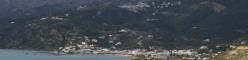
Projects worth more than 3.5 million euros are being tackled for the Plakias tourist region. In particular, the big and important project for the southern tourist community in the regional unit of Rethymnon is on the way to implementation as the Regional Governor of Crete Stavros Arnaoutakis signed the decision to launch the project ‘Upgrading of local road network and selective measures for renewal of public spaces in Plakias settlement ‘ to be included in the Regional Development Program of Crete 2014-2020 with a budget of 1.78 million euros.
The aim of the project is to update and modernize the local coastal road network of the settlement of Plakias, which will also function as a hiking trail and improve accessibility for pedestrians and the disabled.
The project aims to highlight the built environment based on a sustainable approach. Thus, the connection to the beach while respecting the natural environment, the aesthetic and functional enhancement that improves the daily life of residents and visitors and, in general, the support of an urban-social-economic transformation of the area.
According to the project study, in the eastern part of the intervention towards Mirthios, it is planned to keep the central dual carriageway and build sidewalks on both sides of the road. A walkway will be built on the north side of the street, parallel to the drainage line, to allow easy and safe foot traffic in front of the shops in the area. Paths are created on the sea side, while at the end of the intervention a space with canopy and seating areas is created. In the western part of the intervention towards the Sellia area, it is planned to maintain one-way car traffic and to build sidewalks on both sides of the road. The construction of a cycle path is also planned on the sea side. The total length of the intervention is 700 meters.
In detail, according to the study of the project entitled ‘Upgrading of the local road network and selective interventions for the renewal of public areas in the settlement of Plakias’, the following works are planned:
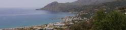
At the same time, according to the mayor, the proposal to construct the Plakias-Souda water supply network and the construction of a new water tank in the Kato Rodakino settlement was included in the specific program for integrated spatial investments, for the inclusion of which in the overall budget a very short-term approval is expected.
The aim of this study is to modernize and optimize the operation of the water supply network in the areas of Plakias, Souda and the settlement of Kato Rodakinos.
The total length of the network is 11,800 m (from Kourtalioti to Plakias) and will consist of one pipeline with a cross-section of Φ200, Φ250 and Φ315 throughout the length.
A tank with a capacity of 500 m3 made of reinforced concrete will be built at the intersection of the pipeline with the Mirthianos-Plakias city road.
At the junction of the pipeline with the municipal road Myrtianos Plakias, a reinforced concrete tank with a capacity of 500m3 will be constructed.
Next September the contractor was selected for another major project in the region involving the construction of the Plakias ring road and the widening of the Plakias-Souda road with a total budget of 1,800,000 euros. There is a contractor for this project, but it takes three months to validate and install the process. Due to the upcoming tourist season, the project will start in the next winter season.
Upon completion of the project, motorists will be able to drive to and from the west side of the settlement and into Souda without having to enter via Plakias.
“We are the first municipality to be approved for inclusion and funding from the CE program. This project will upgrade the area and the entire coastal front and in combination with the construction of the ring road and the widening of the road leading to Souda, for which we already have a contractor, will solve the most important problems that have plagued the region for many years, giving a new development path in the region,” he stressed in statements to “RethNea”. The mayor of Agios Vasileios, Yiannis Tatarakis, adding in relation to the ring road that “This project will not only give traffic breath, but will give a huge development boost and will contribute to the stimulation of the local economy, upgrading aesthetically, functionally and environmentally Plakias, since the movement of vehicles will be carried out outside the main main roads providing great safety for drivers and pedestrians.”
Elpida Aristeidou
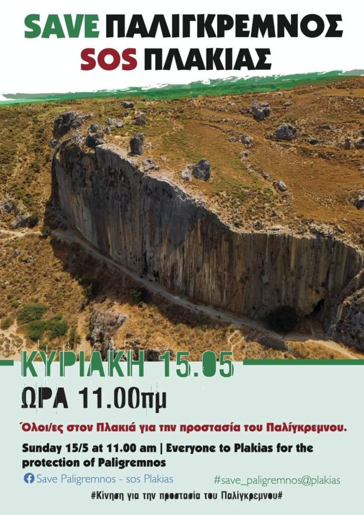
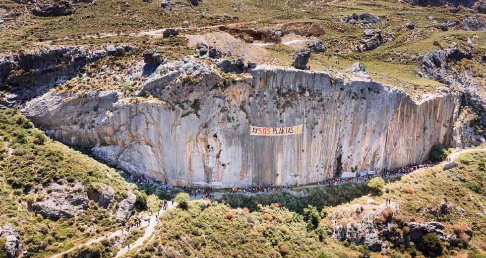
‘On 09.05.2023, the decision was taken by the Ministry of Environment and Energy to declare the area/formation of Paligremnon a Monument and Protected Landscape. The building permit for the construction of a partly underground hotel complex is thus deemed to have been collected and it is the end of private investments there.
This also ends the ‘thriller’ of the year-long struggle against the building permit by YDOM Rethimno (building authority).
NeaKriti writes on 10.05.2023 among other things:
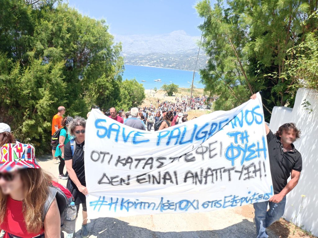
‘The building permit was granted by both the YDOM of Rethymno and subsequently by the excavators who showed up in Paligremnos in May last year and started the road opening. br/ This was followed on May 15, 2022 by a large mobilization with wide participation from Crete to the Rock, which took the form of a movement within Crete but also outside Greece of tourists who had once visited the place. There were also a number of revealing releases from neakriti .gr that revealed unknown aspects of the investment, the backlash from the municipality of Agios Vassiliou and the fact that there was a statutory procedure that was not competently considered and the building permit was granted. The case came to light after neakriti.gr brought documents on an important issue in Parliament and essentially paved the way for the Municipality of Agios Vassiliou to commission the Natural History Museum of Crete to undertake a documentation study for the Paligremnos Protection Declaration, which was approved by the Crete Decentralized Administration and the Regional Council, allowing it to be published in the YP.EN em (Ministry of Environment and Energy, translator’s note) /em and on May 9, 2023, that is yesterday, the decision was issued that finally put an end to the cave hotel. At the same time, there was a legal ‘thriller’ in which the community of Agios Vassiliou tried to obtain an injunction from the Rethymno district court, which they lost due to inadequate documentation. The authorities of Rethymno, but also of all Crete resorted to this before the Administrative Court of Appeal of Chania and a few days ago they managed to revoke the building permit of the hotel. Today comes the decision of the Ministry of the Environment to protect the rock as a natural formation to prevent the cave hotel, designed with great attention to detail and care, from being built!’
‘The Interior Ministry’s decision characterizes, among other things, ‘the Paligremnos area and the Psarela Cape ( em charted name of Cape Kakomouri, translator’s note /em ) of the municipality of Agios Vasilios Rethymno as a protected landscape’. The purpose of this decision, with the designation of the area as a protected landscape, is the effective protection of natural elements that have a special geomorphological, ecological, scientific, aesthetic and cultural value and contribute to the conservation of natural processes and protection of natural resources in the wider area of Paligremnos and Cape Psarela of the Municipality of Agios Vassiliou Rethymno.’
‘The marked area includes all the northern and western inland slopes of the hill of Agioi Saranda, from the area of Paligremnos in the east to the two ends of Cape Psarela in the west, and then the ridge that marks its boundaries on the map (scale 1:2,000) shown as a solid white line, checked by the Head of the Directorate for Topographical Applications, and is an integral part of the present.’
The revelations of neakriti.gr
‘neakriti.gr had published in its previous publications the building permit of the cave hotel, revealing that the investment for the creation of 7 rooms was funded by European funds from the NSRF and in particular the ERDF (Special Regional Development Fund) with 200,000 euros and another 200,000 euros from the investor is promoted. The area appears to be 34 hectares and is leased by the alleged investor as it is owned by a marine engineering company founded in 1949 by her grandfather, a civil engineer. br/ The original area was bought for 171,000 euros and the 1968 contract, which also neakriti.gr brought to light, referred to 160 hectares, with the boundaries reaching the sea on two sides, i. H. within the private property lies the entire rock and cliff! It also appeared that little by little steps were taken to exploit the area, for example in 1993 when the forest area ( em forest areas are lands controlled by the forest authority and may not be built on and are not necessarily wooded, note . by translator /em ) was released and in 2019 the coastline and beach line was demarcated with the shipping company in a hurry. br/ neakriti.gr also brought to light the full planning permission of the investment, as well as all the information about alleged mediations that reached the headquarters of SADAS em (Association of University Graduate Architects, translator’s note /em ) in Athens and about the participation from politicians. At the same time, he unveiled the NSRF funding and contract to acquire the area from the private sector, beginning with the first seller’s usufruct in the 1950’s and then the 1960’s. br/ Important were the revelations of mishandling by local authorities and documents that never reached the municipality of Agios Vassiliou, which would have paved the way for the protection of the landmark three years earlier.’
Save Paligremnos – SOS Plakias at Facebook
neakriti.gr am 18.05.2022 “Investment in Paligremnos”
Translation of the original:
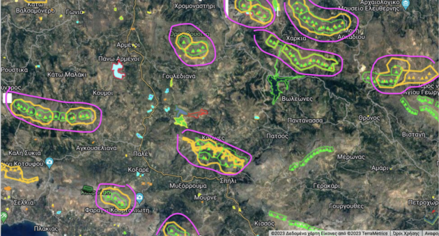
On March 21, the Rethymno Forest Department issued TERNA with a number of permits to install wind turbines at sites in the municipalities of Rethymno, Amari and Agios Vasiliio, many of which are within NATURA protected areas.
This means that the installation of wind farms at these sites is imminent as TERNA has obtained new special project producer licenses for wind projects it has not previously built. So, just looking at the RAE map, it becomes clear that the construction of the pump saving project at Potamion Dam will not prevent the emergence of new wind farms all over Crete, not even in Rethymno. br/ br/ The representatives of OAK em (Organization for the Development of Crete) /em and the Municipality of Amari have convinced the Amariotes that they will be spared from wind turbines if they accept the pump factory. TERNA, who recognized the ‘gallantry/generosity’ of the communities of Amari and Rethymno as she deserved and who granted her their precious water for energy consumption – at the moment when the movement against water privatization is igniting across Greece – is now filling Arcadi and Amari with pinwheels and trying to gain a foothold in the community of Agios Vasilios.
We see how the hinterland of Rethymno is turning into an industrial area and an investment zone that has nothing to do with development or energy transition. This is land grabbing, violent alteration of the unique Rethemniotic cultural and natural landscape and looting by the corporations.
Rethymnon, which was one of the first prefectures to respond to the installation of wind turbines, is once again facing a new onslaught of wind turbines. Now that the anti-wind movement has flared up everywhere and any ‘suspicious activity’ in the mountains, across Greece, is being reported and blocked by hundreds of citizens, TERNA gets approval to install wind towers on ten peaks in the prefecture and it seems like this is just the beginning
On the map of RAE https://geo.rae.gr/?lon=24.617448952459522… we have described in purple the updated facility areas of wind ‘farms’ where permits have been issued for the installation of wind turbines at the following locations:
# ‘CUP 1’, ‘CUP 2’ und ‘GARGANI’ municipality Rethymno, P. H. E. Rethymno.
p.m. CUPS:. Next to Arkadiou Monastery, opposite Amnatos and Kyrianna, above Mesi and Ag. Triada, next to Harkia. The village of Kavousi is entirely within the wind farm!
GARGANI: In the Natura area, in Harkia, above the Potamos dam, next to the upper reservoir of the planned hybrid, opposite Boleones, Pantanassa, Patsos.
# ‘GASPARIS 1’ municipality Rethymno P. H. E. Rethymno.
p.m. GASPARIS: In the Natura – ZEP area (Special Protection Zone for Birds) in Maroulas, above the Prassano Gorge, opposite Chromonastri and Roussiti.
‘AGALI’ Gemeinde Rethymno P.E. Rethymno
Note AGALI : In a Natura – ZEP area (Special Protection Zone for Birds) in Vryssinas, above Roussoapiti and Chromonastiri, above Prasses and the Prassano Gorge.
# ‘MAVROU KORYFI 2’ P.E. Rethymnon
Note MAVROU KORYFI: In the Natura area, above Arkadiou Monastery, opposite Eleftherna, northeast of Ag. Fotini, about Thronos and Kalogeros,
# ‘AGRIMOKEFALA’ Municipality of Rethymno P.E. Rethymno.
Note AGRIMOKEFALA: Southwest of Armeni, south of Agios Konstantinos, above Agouseliana, north of Good Sykia, between Koumon and Mountros.
# ‘KOUROUPA’ and ‘XIRO’ PE Rethymnon.
Note KOUROUPA – DRY: In the Natura Area – ZEP (Special Protection Zone for Birds) on both sides of Kourtaliotis.
KOUROUPA: opposite Atsipades, Koxare, über Asomato, Lefkogia, Myrthios, Mariou, Plakias.
XIRO: next to Frati and Drimisko, above Lefkogia, Gianniou and Preveli Monastery.
# The installation of a wind turbine is also planned in PRASOKEFALA, a rural area between Karines, Lampini, Spili.
The image of the PE of Rethymno on the Energy Regulatory Authority map screams on its own that we should not allow something like this to happen.
Together we can stop them!
COORDINATION OF RETHYMNOU VS VAPE
Taken from Facebook https://www.facebook.com/Συντονιστικό-Ρεθύμνου-κατα-Βιομηχανικών-Ανανεώσιμων-Πηγών-Ενέργειας-ΒΑΠΕ-257113148100336/
Automatically translated, with some corrections by me + italic inserts in brackets.
The original text:
https://acrobat.adobe.com/link/track?uri=urn:aaid:scds:US:ee2c80e6-ba9e-3108-861f-3af1b5c22f3d
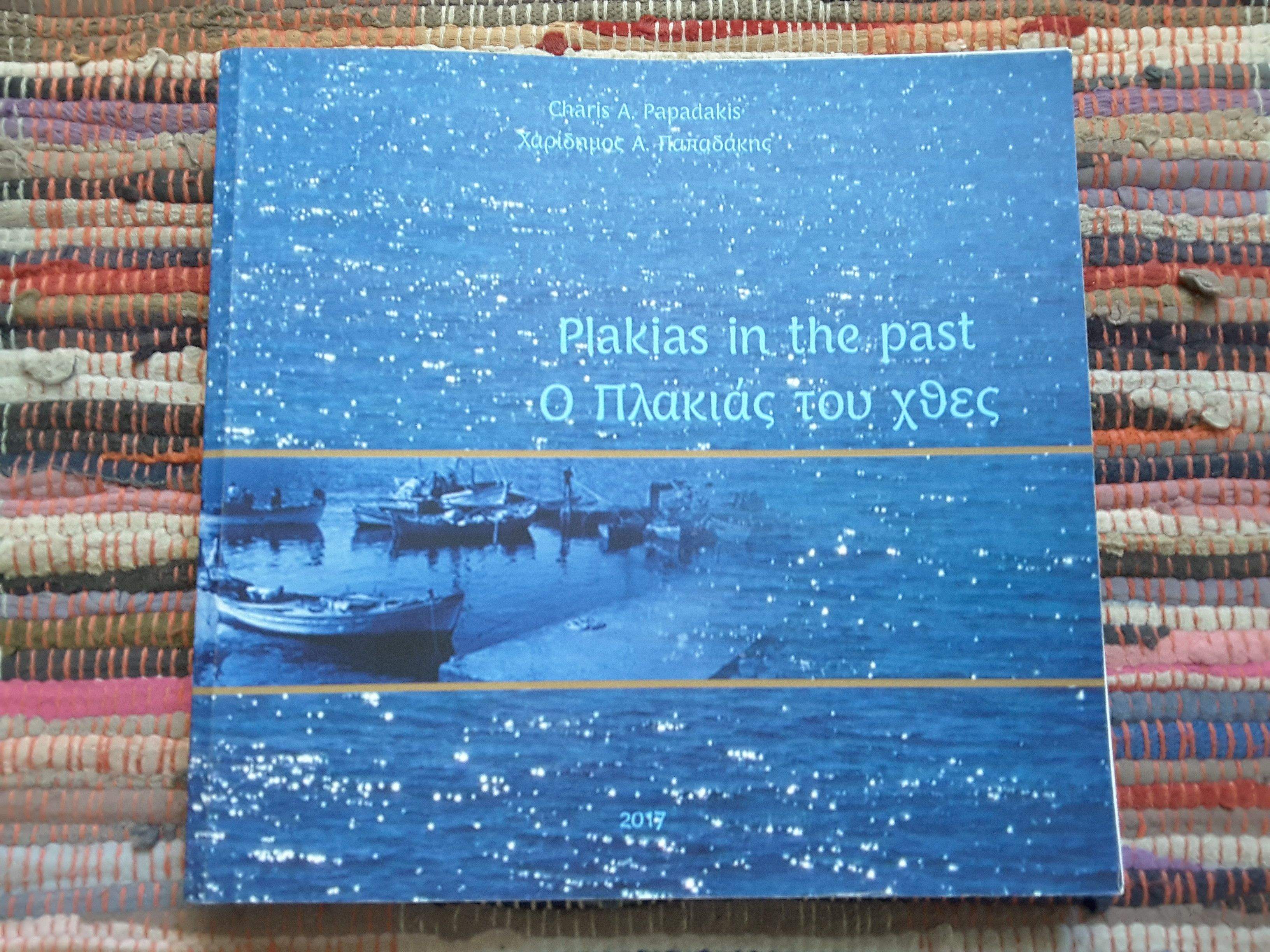
In August of this year, Charidimos (Charis) Papadakis published the second edition of his book about Plakias of the past (before the tourist boom) which was first published as greek only edition in 2010. Now there is not only an added english translation included, but it also contains many “new” old photos. The book is a must read for all friends of Plakias and gives a very good and interesting overview of the development of this place since the very early time, among others very extensively documented in the form of a photo album. Above all, it should not only honor the locals of earlier times, but should also serve as a historical memory for the younger generations.